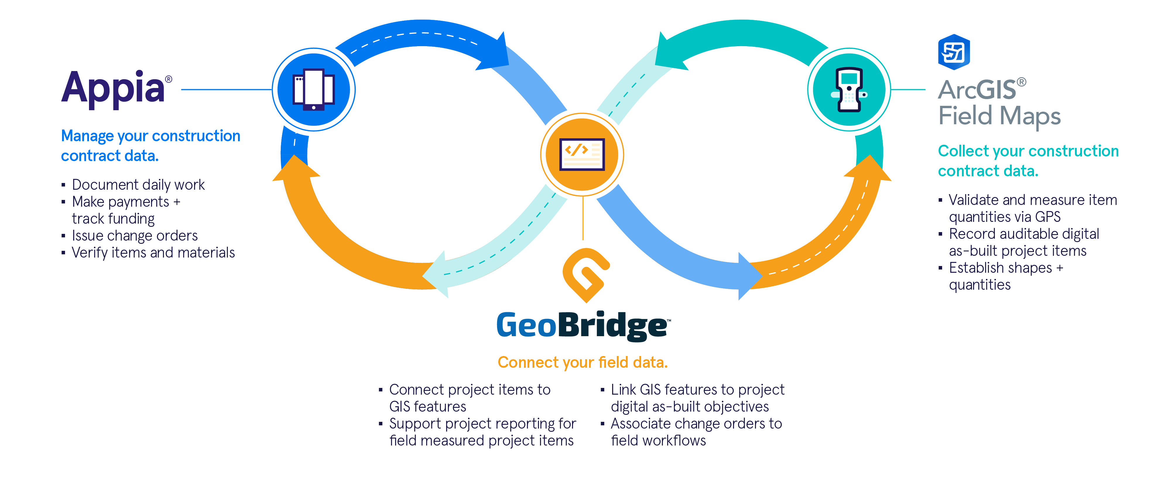

Appia x ArcGIS Field Maps
Connect real-time construction project data to ArcGIS Field Maps via the GeoBridge integration.
By integrating Appia construction data with Field Maps, teams can combine data-driven maps and mobile forms into one convenient, turnkey application that improves transparency and collaboration.
Explore how your organization can connect these powerful applications to create a streamlined workflow for data visualization →